View Slides (PDF) · View Slides (HTML)
Overview
- Facilitated team co-creation sessions to prioritize key target users using persona mapping
- Formulated hypotheses, key research questions, and methodologies to test solutions with consumers
The full story behind this project — alongside the other three from my first two terms — is in A Year at the RCA: Four Projects Across Two Terms.
Time Nov 2023 – May 2024
Team Trisha Fernandes, Yi Chu Chang, Yinan Yang, Xiaoyou Meng, Guan Lin Wu
Partner Arup × Royal College of Art, MA Service Design
Background: The Transition of London's Waterways
London's rivers and canals have undergone a fundamental shift in purpose. In the 1820s, they were vital transportation routes for shipping coal, building materials, and agricultural products. By the 2000s, they have become a thriving part of London's living and leisure landscape — used by houseboats, cruising, and cycling communities.
The Continuous Cruiser
The number of boats on London's waterways has nearly doubled in just over a decade: from 2,101 in 2010 to 2,964 in 2014, 4,098 in 2018, and 4,167 in 2022. These boaters — known as continuous cruisers — are required to moor 21 miles every 2 weeks, managing a complex set of daily tasks:
- Get proper license
- Pay the mooring, council tax
- Fill water tank
- Empty garbage
- Pump-out body waste
- Heating the boat
- Connecting gas tanks
- Connect to electricity
- Fix breakdowns
- Check weather, high/low tides
- Plan journey ahead
Future Trends (PESTLE Analysis)
Three macro trends are shaping the future of waterway living:
- Environment & Technology — Increasing demand for eco-friendly houseboat technologies due to climate crisis. Biofuel hybrid systems and EV charging are being introduced as potential solutions in the near future.
- Social — The number of houseboats in London increased significantly, with a reported 84% surge since 2012, short-term stays in particular.
- Economy & Policy — The growth of canal-side tourism could prompt the authorities to update regulations.
Research: Stakeholder Mapping
We mapped the entire ecosystem around waterway living and identified multiple frictions between stakeholders.
The Stakeholders
- Boaters — The continuous cruisers living on the waterways, represented partly by the NBTA (National Bargee Travellers Association) who help boaters check routes and advocate for their rights
- Infrastructure — Physical facilities along the canals including EV charging spots, maintenance spots, garbage bins, sewage pumps, and water points. The top-tier facilities (EV, maintenance) are not integrated with the basic utilities below, and the basic utilities suffer from regular dysfunction
- Digital System — CRT's existing digital layer: a public-facing website, a GIS real-time database, and a boater license database. These systems are disconnected — boaters get no instant updates, and the GIS database requires manual checks from CRT staff
- CRT (Canal & River Trust) — The governing body with Engineering, Legal, Communication, and Impact teams. They face delayed maintenance due to limited resources and limited budget from government
- Government — DEFRA and Local Councils provide funding to CRT but with constrained budgets
- Third-party Providers — External service providers with unstable collaboration with the infrastructure network
The core problem: boaters depend on infrastructure that breaks down regularly, managed by a system that can't detect or respond to issues in real time, governed by an organisation with insufficient budget and no integrated data.
Insight: The Information Gap
Two fundamental gaps emerged from our research:
1. Predictive decisions cannot be made due to the lack of a data system
| Boaters | CRT | |
|---|---|---|
| Need | Good facilities to sustain life and living quality on water | Digitalised way to manage waterway |
| Insight | Freedom of mobile housing but challenges of stationary facilities and regulations | Currently use manual approach to track and manage the whole waterway |
2. Values and priorities are not aligned between boaters and CRT
| Boaters | CRT | |
|---|---|---|
| Need | Recognised and qualified same as residents | Budget limited but required to overlook the whole waterway |
| Insight | Physiological needs (water, electricity, address service) must be assured as land residents | From the managing end, the water body itself takes the priority instead of the people living on it |
How might we bring transparency and better organise services that help reduce the tension between the boaters, authorities, neighbours, and nature?
Our Service: Anchor
Anchor is a waterway housing assistant that simplifies boaters' lives. The service operates across four layers:
- Digital Platform — The app provides boaters access to real-time data to plan their moorings and utilities of mobile housing
- Infrastructure — App integrated with upgraded infrastructure enables users to use facilities with convenience. Report breakdowns, read and write reviews, then the usage data can be saved for building better service hubs/boats
- Resources Providers — The service partners with resource providers to enhance the management of the utilities, mooring spots, and towpaths
- Waterways System — Overall, the service aims to bring a structure to the waterways living market with streamlined offerings
The Anchor App
Three core features:
- Smart Navigator — The app suggests available mooring spots, facilities on the route, and even shows the traffic, tide, and weather data
- Planning and Tracking — The boater does not have to manually track and plan housing utilities. All is captured in the app with recommendations on dates to refill/empty resources
- Reports, Reviews and Rewards — A platform to report broken infrastructure, write and read reviews of the boater community, and earn rewards by engaging with the system
The User Journey
The Anchor experience maps to five phases of the boater's bi-weekly cycle:
- Planning — Plan next mooring, match with life schedule, plan refill/emptying resources
- Mooring Day — Pack for mooring, check weather/tide/route/locks, coordinate with co-cruiser, set sail
- Use Utilities — Halt for water filling, re-fuel/charge batteries, pump-out body waste, empty trash, wait and queue to use facilities
- Cruising to Spot — Take note of tasks done, continue trip, see available spots
- Moor at Spot — Moor at a new spot, tie the boat, meet new neighbours, step out for other activities
Value Proposition: Convenience with Real-time Data
The value proposition canvas maps how Anchor addresses the boater's jobs, pains, and gains:
User Jobs: Get mooring spot, organise mooring, plan for physiological needs, stay aware, pack for cruising, deal with uncertainty, constantly check the boat, keep tracking
Pains: Exhausted on planning, hard to find a spot, cruise for hours, reduced mooring spots, lots of manual work, feel unrecognised, feel unsafe, waste time on broken facilities, low/no support from CRT
Gains: Well organised facilities, low living cost, more mooring spaces, heard as community, freedom of living on water, sense of security, residential identity, treated equally as residents
Our Service delivers:
- Gain Creators — Integrated services, safety, mooring structure, identity, upgraded facilities
- Pain Relievers — Blocking mooring, map, live traffic, safety lights, suggestions, predictive data
- Service Components — Service hub, digital platform, service boat, real-time data
Blueprint: Flow & System behind Touchpoints
The service blueprint maps the full journey from before mooring (30 min) through during mooring (1–5 hours) to after mooring (30 min), spanning four layers:
- User Journey — Sign up → search for mooring → navigate → check facilities → update status → use facilities → report issues → cruise back → charge boat
- Frontstage Actions — Login, browse digital mooring map, follow navigation, browse facilities, click temporary leave, browse mooring map, open error reporting, click return, connect with EV
- Technology (Backstage) — Login system, sensor/GIS/GPS mapping, canal database, facilities database, mooring system, reporting system, EV charging system
- Supporting System — Third-party design & development, CRT workers updating synchronic data of canals and facilities, maintenance workers, EV supplier
Stakeholder Map — Adjusted: Data Exchange to Anchor the Frictions
With Anchor in place, the stakeholder dynamics shift:
- Boater → Anchor: Plan, Report (boaters actively feed data into the system)
- Anchor → Infrastructure: Access, Use (with data updating facility status in real-time)
- Anchor → CRT: Data Update (replacing manual checks with live data streams)
- Infrastructure ↔ Third-party: Foster Integration (where previously not integrated)
- CRT ↔ Third-party: Foster Collaboration (where previously unstable)
- Government → CRT: Negotiated Budget (data-backed case for funding, replacing limited budget)
The key shift: unbuilt connections become built ones. Anchor serves as the data exchange layer that reduces friction across the entire ecosystem.
Business Model: Data-driven Revenue Stream
Anchor's revenue model operates on a freemium subscription:
Free tier:
- Waterway map
- Route planning
- Facility information
Paid features:
- Ad-free experience
- Block mooring space while using facilities
- Points reward system
Revenue flows through the app (ads + subscription), with the database feeding value back to infrastructure and CRT. Boaters pay for premium features; infrastructure benefits from usage data; CRT gains a management tool.
Vision
Creating a water living model for Rivers and Canals of London that is sustainable, driven by data, and promoting harmony among stakeholders.
Prospect Future
An integrated service hub and mobile service boat to enhance facilities experience — featuring interactive kiosks, facilities status displays, water outlets, smart bins, safety lights, tools vending machines, EV charging, and body waste pump-out stations.
Implementation Roadmap
| Short Term (1–3 yrs) | Mid Term (3–10 yrs) | Long Term (10–20 yrs) | |
|---|---|---|---|
| Infra & Service Hub | Digitalised facilities — update synchronic status | Monitor on facilities remotely; EV charging spot network | Integrated service hub; mobile service boat |
| Digital System | Mooring planner; instant facility map | Reporting system; data stream & database | Canal managing system; living on water system |
Validation and Reflections
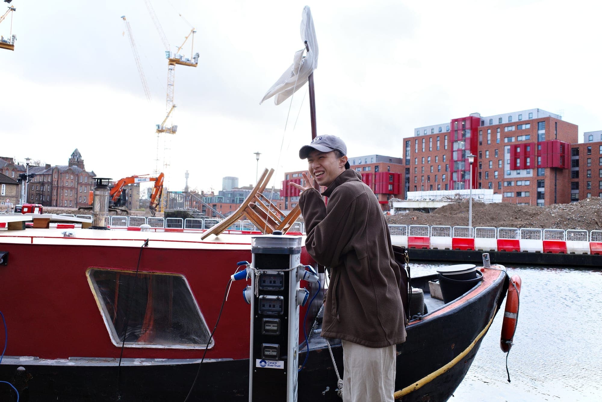
We validated Anchor through on-site research on boats along London's canals, co-creation sessions with boaters and CRT stakeholders, and a final presentation to the Arup team. The project demonstrated that the city itself can be redesigned as a service — where infrastructure, data, and community converge to support a form of living that sits outside traditional housing models.